Make your project visible, credible, and fundable
The explorer.land Project Directory lets you showcase your project on a public, interactive map — with geolocated stories, media, updates, and impact information that builds trust with funders and stakeholders.

Your Project. Your Story. On the Map
The Project Directory is the public face of your restoration, conservation, or carbon project.
It’s designed to help you move beyond reports and PDFs—offering an interactive, SEO-friendly map where anyone can explore your project, understand your impact, and connect with you.
🌍
Visibility
Be discoverable by funders, partners, and the public
🧭
Transparency
Share verifiable, geolocated updates that build trust
🚀
Fundraising
Convert visibility into support with sponsor features
How it works
Key features
Interactive Map
Project Profile

Certifications

United Nations Sustainable Development Goals (SDGs)

Multistakeholders

Analytics
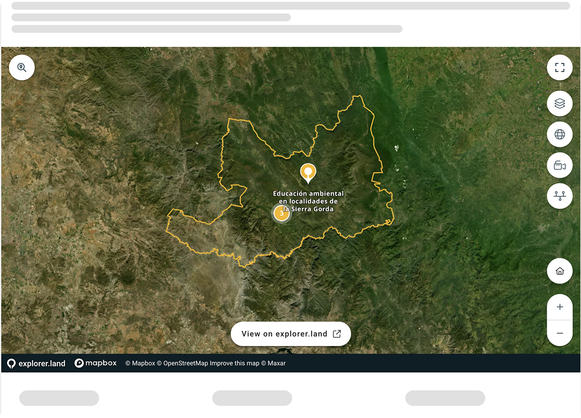
Embed your map

Funding opportunities
Case Studies
Trusted by +2,000 users around the world

Thanks Alexander Watson, we love using explorer.land maps for storytelling and transparency. It's an excellent tool that gives our clients an opportunity to really dive into our projects 🌲

Since engagement in explorer.land, potential clients, and partners are contacting us. It is a wonderful platform with a super-wide network of potential clients and partners. It has helped us a lot in moving forward with our ecosystem restoration activities. Not only because we can prove exactly what we are doing, but it has also put us in contact with various international clients and partners. The platform really works for us.

An important part of my role at Greenpop is to authentically and transparently communicate the impact of our work to our donors. explorer.land has helped me visually communicate our work. It has combined many of the goals we have for project communications into an easy-to-use platform. The service we have received from the explorer.land team has been exceptional.

OpenForests’ web map has been a fantastic tool to visualize our reforestation project El Silencio for fundraising.

I really love the mobile UI! I know that challenge from Terrastories, and I think you’ve done an excellent job approaching it. I played around with the page and map, and as before, experienced that everything is as intuitive as I expect it to be. Really great stuff!
With the multistakeholder module we could bring all our members and their projects onto one map. In fact, the prospects of using the map-based membership platform is more promising than originally anticipated. We're looking forward to develop the tool together with OpenForests to also meet future, additional demands. The official launch of the map with a video and an article published by Mongabay turned out to resonate very well with our membership as well as outside organisations (e.g., the UN Decade on Ecosystem Restoration) and media.
FAQ
Restoration and conservation initiatives (e.g., projects or programs of NGOs, social enterprises, private companies, or local to national governments) use the platform to document and display their progress and impact. They use explorer.land to tell their impact story transparently, to immerse stakeholders in place, and to engage with supporters.
Funders, purpose-driven businesses, sustainable brands, and buyers of forest goods and services (including carbon) use the platform to find transparent and interesting projects to support and collaborate with.
Explorer.land is a map-based platform showcasing restoration and conservation initiatives in a transparent yet engaging way. Restoration and conservation initiatives use explorer.land to document and display their progress via interactive maps and geo-located content (e.g., news posts and photos). Functions such as the call-to-action button facilitate immediate engagement with supporters. Funders, purpose-driven businesses, and buyers of forest goods and services use the platform to find interesting projects to support and collaborate with. The interactive home page, which includes different search possibilities, allows for easy navigation and filtering of projects according to criteria. Thematic global data layers, 3D views, and the integration of high-resolution drone or satellite imagery support transparency, engagement, and immersion in an initiative’s context and impact.
Think of it as a PowerPoint presentation that uses maps instead of slides!
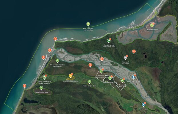
A map-based project presentation displays and connects all sites of a restoration or conservation initiative (e.g., tree nurseries, education centers, reforestation areas, conservation sites, agroforestry production) and links them to relevant content. Initiatives can tell their story in space and time (e.g., showcase what kind of trees have been planted where and when, how forest cover has evolved over time, etc.). They can post news and photos and link them to specific sites. All content is localized and interactively connected to a map. 3D views provide for an immersive geographical experience of each site, as well as the possibility of integrating high-resolution drone and satellite imagery.
Map-based project presentations include key facts such as project type (e.g., reforestation, agroforestry), location of sites, important dates (e.g., start date), status, and other descriptors. Geo-located news posts and photos can link to different site locations. Content is structured via the tabs menu: Home, About, News, Sites, Partners, Sponsors, SDGs, Goods, Contact. All involved stakeholder groups (e.g., partners, sponsors) can also be linked to specific site locations.
Users can select from a variety of satellite base maps such as Mapbox, Esri, and Bing. We integrate third party thematic global data layers provided by Global Resources Watch (e.g., forest cover), GLOBIL (drone maps), TerraPulse (forest cover, biomass). We are continuously adding new thematic data layers so do check out our library often.


