
Global coverage
Monitor your project area and buffer zones remotely via satellite technology.
Localization and quantification
Deforestation detection
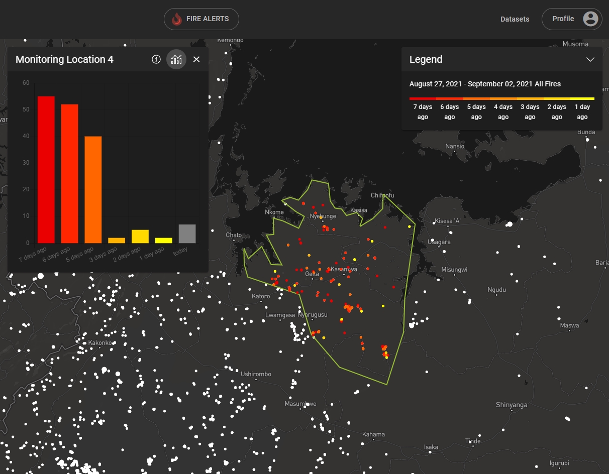
Fire monitoring
Receive alerts
Carbon
Deforestation
Reforestation
Biodiversity
Fire
Forest monitoring data integration
We combine various high-quality data sources with a focus on open-source data. Proprietary data from third-party providers can be integrated via our API.
Essential Functions
All in one place to manage your location data and to continuously monitor wildfires, deforestation, and reforestation success.
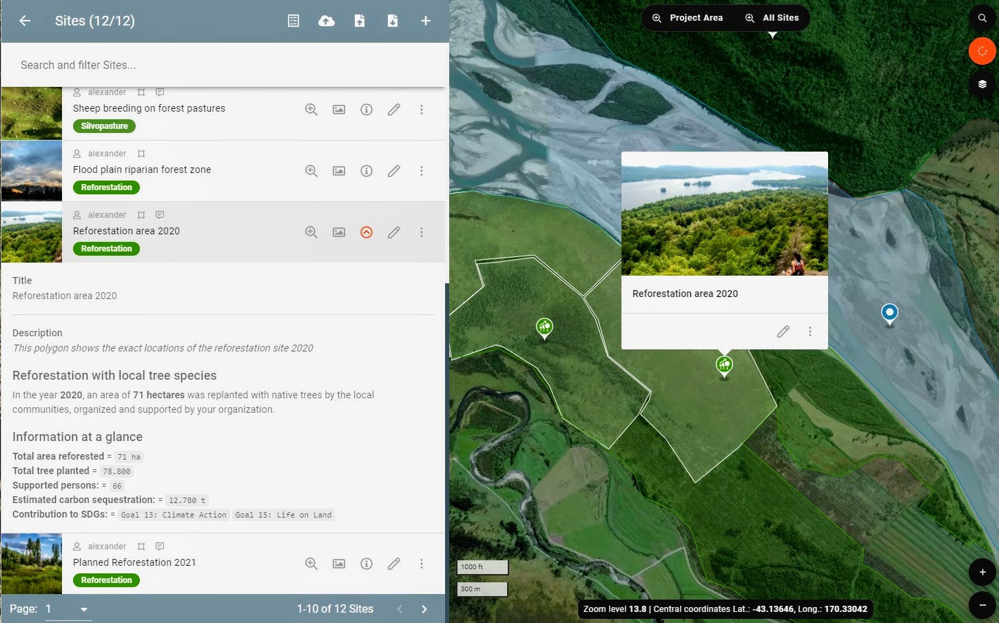
Easy geodata management
Be in control of your data. Import, download, synchronize, and edit all your geodata with an intuitive user backend. Data management takes place on explorer.land.
Draw locations
Quickly add and change polygon shapes. No need to wait for the GIS expert to support you with geodata management. All authorized users can view and edit project data via the user backend.
Analyze fire and deforestation events
Overview project locations and instantly analyze fires and unplanned deforestation events via intuitive maps and charts.
Monitor your reforestation success
Automate your regular forest monitoring with high-resolution NDVI imagery and canopy cover classification.
All what is needed
Comprehensive service for monitoring and data management
Team work
Share data
Onboarding
Open-source data
Data security
Third party API
Frequently Asked Questions
We integrate various data sources and remote sensing products for forest monitoring applications. For deforestation and reforestation monitoring, the monitoring layers are created by multispectral or radar satellite sensors. Fire is detected via thermal sensors. In contrast to this, the biodiversity layer uses various data inputs including from on the ground surveys.
We prefer the integration of open-source data. However, for specific cases, open-source data sets do not offer the same quality as commercial monitoring data layers. On-demand we also integrate additional commercial monitoring data sets.
This depends on the data layer. For the fire monitoring the data gets updated every 24 hours. Deforestation monitoring updates are delivered on a weekly basis. Key Biodiversity Areas are only updated twice a year.
All of your project locations, e.g. geodata is managed via the explorer.land backend. You can import or draw your polygons right in the user backend or we support you with your geodata import. The initial portal set up is conducted by the OpenForests team.
The monitoring data is offered via our online portal. No additional hardware or desktop installments are required.