How to explore projects
Search and find inspiring restoration and conservation projects by categories and free search.
Browse global map
Explore the global map. Zoom into a region of interest and click on a project marker to fly into the project presentation.

Search filter
Filter by search categories to find inspiring conservation, reforestation, agroforest, and landscape restoration projects.
Discover the project
Content in project presentations is geo-located, i.e., dynamically connected to specific sites on the map. A project can contain multiple sites (e.g., nurseries, conservation areas, production areas). Content can be structured and viewed via the tabs menu in each project presentation: Home, About, News, Sites, Partners, Sponsors, SDGs, Goods, Contact.
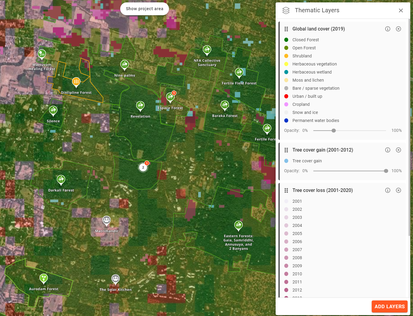
Analyze with data layers
A growing library of global data layers such as deforestation, forest fragmentation, tree cover, soil carbon, and tree biomass density can be selected to show the context and impact of projects.
Restoration and conservation initiatives (e.g., projects or programs of NGOs, social enterprises, private companies, or local to national governments) use the platform to document and display their progress and impact. They use explorer.land to tell their impact story transparently, to immerse stakeholders in place, and to engage with supporters.
Funders, purpose-driven businesses, sustainable brands, and buyers of forest goods and services (including carbon) use the platform to find transparent and interesting projects to support and collaborate with.
Explorer.land is a map-based platform showcasing restoration and conservation initiatives in a transparent yet engaging way. Restoration and conservation initiatives use explorer.land to document and display their progress via interactive maps and geo-located content (e.g., news posts and photos). Functions such as the call-to-action button facilitate immediate engagement with supporters. Funders, purpose-driven businesses, and buyers of forest goods and services use the platform to find interesting projects to support and collaborate with. The interactive home page, which includes different search possibilities, allows for easy navigation and filtering of projects according to criteria. Thematic global data layers, 3D views, and the integration of high-resolution drone or satellite imagery support transparency, engagement, and immersion in an initiative’s context and impact.
You find projects by free exploration of the map or by filtering by search categories. Search categories include project type (e.g., agroforestry, conservation, restoration), goods produced (e.g., coffee, timber, herbs), country of project, and participating organizations.
Yes, project and organization profiles are optimized to be found by search engines.