

Impact Monitoring Dashboard

Your Impact made visible. Finally.

Track, visualize and report the impact of your nature restoration efforts with our Impact Monitoring Dashboard.   

Impact Monitoring
Impact Monitoring

Get ready for transparent reporting

Restoration and conservation projects are long-term commitments, but measuring their true impact doesn’t have to be a guessing game.

Our platform helps you transform complex, interconnected project data into a clear story.

With a simple, easy-to-use theory of change, map your project’s activities to verifiable outcomes and indicators, ensuring everyone understands and trusts your progress—from field teams to funders.

Evidence-based

Traceable and measurable outcomes, not just claims.

Key Insights

Transparent reporting for funding, validation, and public trust.

EUDR Support

Impact tracking that helps you align with EUDR requirements.

Key features

Highlight

Choose your Impact Framework

Select from established frameworks like SDGs, 4Returns, or your own Theory of Change. Align your reporting with global standards and speak the same language as funders and regulators.


UN SDGs
Highlight

Indicator Health Status

See at a glance how each indicator is performing with a clear, color-coded health status system.


Highlight

Different Types of Data Entry

Easily capture both qualitative and quantitative data — from remote sensing results to field surveys and community inputs.


Custom Indicators

Define what really matters to your project. From biodiversity metrics to social outcomes, design and upload your own indicators.

Choose what you share

Decide which data is public, private, or only available to select funders and partners. You stay in control.

Notifications

Stay on track with automatic reminders when it’s time to update your indicators.


Book a demo

Designed for Nature-Based Solution Leaders

Restoration & Rewilding NGOs

Bring your projects to life with interactive maps, transparent reporting, and storytelling tools that build trust and attract support.

Landscapes Initiatives

Coordinate stakeholders, monitor impact at scale, and manage diverse projects within one transparent landscape framework.

Sponsors & Funders

Gain real-time visibility into project performance, due diligence, and impact metrics—backed by geo-data and transparent reporting.

Simple Setup. Powerful Results.

1. Select framework

Choose from global standards like SDGs, 4Returns, or your custom Theory of Change to anchor your monitoring.

2. Define indicators

Pick from predefined indicators or set up your own to measure what truly matters.


3. Upload data

Easily import field data, remote sensing results, or partner datasets to keep your dashboard current.


4. Visualize & Share

Turn raw data into clear dashboards and maps that build trust with funders, communities, and the public.

Book a demo

explorer.land's ecosystem

Interactive Map

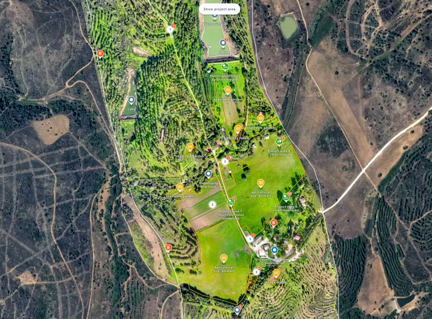
Put your projects on the map. Manage sites, monitor progress, and communicate impact through interactive maps designed for collaboration and trust.

Sponsor Management

Show your partners the value they create. Manage sponsors with ease, highlight contributions, and give them branded views that build trust and recognition.

Geoanalytics

See beyond the surface. Leverage geospatial insights to measure change, compare scenarios, and unlock new dimensions of understanding for your projects.

Public Project map

Share your work with the world. A public-facing map that showcases your impact, invites engagement, and makes transparency your strongest asset.

Testimonials

Trusted by 900+ organizations

Impact Monitoring

Thanks Alexander Watson, we love using explorer.land maps for storytelling and transparency. It's an excellent tool that gives our clients an opportunity to really dive into our projects 🌲

ClimatePartner Impact
Impact Monitoring

Since engagement in explorer.land, potential clients, and partners are contacting us. It is a wonderful platform with a super-wide network of potential clients and partners. It has helped us a lot in moving forward with our ecosystem restoration activities. Not only because we can prove exactly what we are doing, but it has also put us in contact with various international clients and partners. The platform really works for us.

Paul Burgers, Ph.D.
CEO of CO2 Operate B.V.
Impact Monitoring

An important part of my role at Greenpop is to authentically and transparently communicate the impact of our work to our donors. explorer.land has helped me visually communicate our work. It has combined many of the goals we have for project communications into an easy-to-use platform. The service we have received from the explorer.land team has been exceptional.

Carla Wessels
Partnerships & Communications, Greenpop
Impact Monitoring

OpenForests’ web map has been a fantastic tool to visualize our reforestation project El Silencio for fundraising.

Fernando Arbeláez
President, Fundación Biodiversa Colombia
Impact Monitoring

I really love the mobile UI! I know that challenge from Terrastories, and I think you’ve done an excellent job approaching it. I played around with the page and map, and as before, experienced that everything is as intuitive as I expect it to be. Really great stuff!


Rudo Kemper
Manager, Mapping & Programs Support, Amazon Conservation Team
Impact Monitoring

With the multistakeholder module we could bring all our members and their projects onto one map. In fact, the prospects of using the map-based membership platform is more promising than originally anticipated. We're looking forward to develop the tool together with OpenForests to also meet future, additional demands. The official launch of the map with a video and an article published by Mongabay turned out to resonate very well with our membership as well as outside organisations (e.g., the UN Decade on Ecosystem Restoration) and media.

Magnus Sylvén
Co-Director, Global Rewilding Alliance

Frequently Asked Questions​

Can multiple team members manage our organization’s account?

Yes. You can invite team members, assign permissions, and collaborate on your project portfolio.

Can I embed my explorer.land map on my website?

Yes, with our widget feature you can embed your interactive map and/or dashboard directly on your website, with your branding.

Can I use it as a white label?

Yes. For large-scale or institutional users, we offer white-label options and custom integrations.

Can we integrate explorer.land with our internal monitoring tools?

Yes. We offer API access and can help with custom integrations to connect explorer.land with your MRV systems, dashboards, or databases.